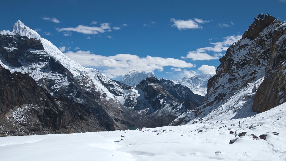
🏔️ Tectonic Architecture: The Collision That Reshaped Earth’s Climate and Crust
Mountain building (orogenesis) represents the most dramatic physical manifestation of plate tectonics. The collision between the Indian and Eurasian continental plates—initiated approximately 55 to 50 million years ago and actively continuing today—has constructed the highest topographic relief on our planet: the 2,500-kilometer-long Himalayan mountain range and the 2.5-million-square-kilometer Tibetan Plateau. This tectonic collision doubled continental crustal thickness, initiated the Asian monsoon, and altered global Cenozoic geochemical cycles.
1. The Continental Collision Cycle: From Neo-Tethys Subduction to Hard Collision
Prior to continental collision, the Indian tectonic plate was an isolated continental fragment that had rifted away from the southern supercontinent Gondwana during the Early Cretaceous (~130 Ma). Propelled northward across the ancient Tethyan oceanic realm at plate velocities exceeding 15 to 20 cm/year—the fastest sustained continental drift rate recorded in the geological record—India consumed the oceanic lithosphere of the Neo-Tethys Ocean along a north-dipping subduction zone beneath the southern margin of Eurasia.
Subduction of the Neo-Tethyan oceanic slab generated the calc-alkaline Gangdese (Trans-Himalayan) volcanic arc along the southern edge of Tibet. However, by approximately 55 to 50 Ma (Early Eocene), the oceanic realm was completely consumed. The buoyant, low-density continental crust of the northern Indian margin arrived at the trench. Because continental crust has an average density of ~2.7 g/cm³—far too buoyant to subduct deep into the denser asthenospheric mantle (~3.3 g/cm³)—the subduction process choked.
Rather than sliding peacefully beneath Eurasia, the Indian continental crust underwent catastrophic compression, buckling, and horizontal shortening. The collision transformed from oceanic-continental subduction into a continental collision orogen, driving immense crustal thickening that doubled the continental crust beneath Tibet to an unprecedented thickness of 70 to 80 kilometers.
2. Orogenic Wedge Mechanics: Critical Taper Theory and Thrust Belt Progression
To understand the structural geometry of the Himalayas, tectonicists employ the Critical Taper Wedge Theory, formulated by Dan Davis, John Suppe, and Frank Dahlen. In this mechanical model, an accretionary or collisional mountain belt is treated as a wedge of Coulomb-frictional material pushed along a basal detachment fault termed a decollement—in the Himalayas, the Main Himalayan Thrust (MHT).
Like snow pushed in front of a snowplow blade, the orogenic wedge deforms internally by folding and faulting until it attains a critical taper angle (the sum of the surface topographic slope α and the basal fault dip β). If surface erosion strips rock from the top of the wedge, the taper angle drops below criticality, forcing the wedge to shorten horizontally and thicken vertically through internal fault slip to restore equilibrium. Conversely, if tectonic underplating at the base steepens the taper beyond criticality, the wedge extends along extensional collapse faults.
As the Indian plate continues to underthrust Eurasia at a contemporary rate of ~40 mm/year (with roughly 20 mm/year absorbed directly across the Himalayan front), deformation has propagated progressively southward through four major fault systems that segment the Himalayas into four distinct lithotectonic zones:
| Lithotectonic Zone | Dominant Lithologies | Boundaries (North / South) | Metamorphic Grade | Geological Evolution |
|---|---|---|---|---|
| Sub-Himalaya (Siwaliks) | Fluvial sandstone, siltstone, conglomerate molasses | Main Boundary Thrust (MBT) / Main Frontal Thrust (MFT) | Unmetamorphosed (diagenetic) | Neogene-Quaternary foreland basin synorogenic sediments |
| Lesser Himalaya | Proterozoic to Paleozoic quartzites, phyllites, schists | Main Central Thrust (MCT) / Main Boundary Thrust (MBT) | Greenschist facies (chlorite, biotite, garnet) | Inverted metamorphic sequence, Indian passive margin cover |
| Greater Himalayan Sequence | High-grade migmatites, paragneisses, leucogranites | South Tibetan Detachment System (STDS) / Main Central Thrust (MCT) | Upper amphibolite to granulite (kyanite, sillimanite) | Exhumed metamorphic core complex, channel flow ductile extrusion |
| Tethyan Himalaya | Marine limestone, shale, sandstone (Cambrian to Eocene) | Indus-Yarlung Suture Zone (IYSZ) / South Tibetan Detachment System (STDS) | Anchizone to lower greenschist | Deformed sediment sequence of the ancient Neo-Tethys shelf |
| Indus-Yarlung Suture Zone | Ophiolite suites, serpentinites, radiolarian cherts | Gangdese Arc / Tethyan Himalaya | High-pressure blueschists to greenschist | The physical fossil tectonic scar marking the consumed Neo-Tethys |
3. The Inverted Metamorphism Paradox and the Main Central Thrust (MCT)
One of the most celebrated structural enigmas in geology is the inverted metamorphic sequence exposed across the Lesser and Greater Himalayas. In standard crustal profiles, metamorphic grade increases downward with increasing depth and temperature (Barrovian sequence: chlorite → biotite → garnet → staurolite → kyanite → sillimanite). In the Himalayas, however, field geologists traversing upward through the structural section encounter higher-grade metamorphic rocks overlying lower-grade rocks!
This inverted thermal gradient is localized across the Main Central Thrust (MCT)—a ductile shear zone several kilometers thick that accommodated over 150 to 250 kilometers of southward displacement during the Miocene (~22 to 15 Ma). Two primary models explain this thermodynamic inversion:
1. Thermal Shearing and Hot Overthrusting: The hot, ductile Greater Himalayan crystalline metamorphic core (temperatures >700°C) was thrust southward over the cold, brittle Lesser Himalayan metasedimentary basement. Conductive heat transfer from the hanging wall heated the footwall from above, while shear strain heating along the MCT shear zone generated intense localized metamorphism.
2. Ductile Extrusion and Channel Flow: In the modern channel flow model proposed by Chris Beaumont and colleagues, the middle crust beneath Tibet underwent widespread partial melting, creating a low-viscosity, ductile channel. Tectonic pressure combined with intense, localized monsoonal precipitation and denudation along the Himalayan front sucked this hot, partially molten mid-crustal channel southward between two bounding shear zones: the Main Central Thrust at the base (thrust sense) and the South Tibetan Detachment System (STDS) at the top (normal extensional sense). This ductile extrusion carried sillimanite-grade gneisses and Miocene tourmaline leucogranites directly to the surface.
🔬 Metamorphic Petrology Benchmark: Inverted Barrovian Zonation
Nowhere else on Earth can a field geologist walk uphill along mountain gorges and observe chlorite phyllites transition progressively into staurolite schists, kyanite gneisses, and finally partial-melt migmatites. This inverted sequence stands as direct physical proof of ductile crustal extrusion during active continental collision.
4. Tectonic Escape (Lateral Extrusion) and the Tibetan Plateau
As the rigid Indian plate continued to ram into Eurasia, the vast continental interior could not accommodate indefinite vertical crustal thickening. By approximately 15 Ma, the Tibetan Plateau reached a maximum sustainable topographic elevation of approximately 5,000 meters above sea level, where the gravitational potential energy of the high plateau equaled the tectonic compressive forces.
Faced with this mechanical limit, the deformational regime transitioned into tectonic escape or lateral extrusion, formulated by Paul Tapponnier and Peter Molnar. Continental lithospheric blocks of southeastern Asia were squeezed laterally eastward out of the collision zone toward the Pacific and South China Sea along giant strike-slip faults: the Altyn Tagh Fault, the Karakoram Fault, and the Red River Fault.
Concurrently, the interior of the Tibetan Plateau entered a phase of east-west extensional collapse. North-south trending grabens (such as the Yadong-Gulu rift) opened across southern Tibet, accommodating extensional strain through normal faulting, accompanied by basaltic-potassic volcanism and geothermal geyser fields.
5. Orogenic Climatology: The Himalayan Uplift and the Asian Monsoon
The physical construction of the Himalayan orogen fundamentally altered global atmospheric circulation and planetary climate. Prior to orogenesis, eastern Asia was dominated by arid to semi-arid conditions. The dramatic uplift of the 5,000-meter-high Tibetan Plateau created an enormous thermodynamic heat pump in the middle troposphere:
During summer months, intense solar heating of the elevated plateau surface warms the air, causing it to rise vigorously. This creates a colossal low-pressure cell over Tibet that draws moisture-laden maritime air masses from the Indian Ocean northward across the Indian subcontinent. When these humid air masses slam into the vertical 8,000-meter wall of the Himalayas, dramatic orographic precipitation is triggered. The southern Himalayan slopes receive over 3,000 to 11,000 mm of annual rainfall (e.g., Cherrapunji), driving ferocious river incision, while the plateau behind the range is left in a hyper-arid rain shadow.
This coupled relationship between climate and tectonics represents a profound positive feedback loop: monsoonal rainfall accelerates erosion, which unroofs ductile metamorphic rocks, which in turn draws more crust into the orogenic wedge, focusing mountain building along the monsoon front.
6. Silicate Weathering and Global Cenozoic Cooling
Beyond regional monsoon dynamics, the Himalayan collision is widely recognized as a primary driver of long-term global climate cooling over the past 50 million years—the transition from the greenhouse Eocene world to the icehouse Pleistocene world. This connection, formalized by the Raymo-Ruddiman Uplift-Weathering Hypothesis, links plate tectonics to the geochemical carbon cycle:
The rapid tectonic exhumation of fresh, unweathered silicate minerals (calcium- and magnesium-rich feldspars, micas, and pyroxenes) across the steep Himalayan slopes exposes vast mineral surface areas to warm, acidic monsoonal rains. Atmospheric carbon dioxide dissolves in rainwater to form carbonic acid (H₂CO₃), which chemically weathers calcium silicate minerals:
CaSiO₃ + 2 CO₂ + H₂O → Ca²⁺ + 2 HCO₃⁻ + SiO₂
The dissolved calcium (Ca²⁺) and bicarbonate (HCO₃⁻) ions are flushed down the Indus, Ganges, and Brahmaputra river systems into the Indian Ocean, where marine organisms (foraminifera and coccolithophores) precipitate them as calcium carbonate (CaCO₃) shells, burying carbon in deep-sea sediment. This massive chemical drawdown of atmospheric CO₂ permanently lowered greenhouse radiative forcing, triggering the glaciation of Antarctica at the Eocene-Oligocene boundary (~34 Ma) and the onset of Northern Hemisphere glaciation.
7. Seismic Geodesy and Active Neotectonics of the Himalayan Megathrust
The physical compression between India and Eurasia is not an ancient fossil event; it is an intensely active seismic process occurring in real time. Continuous Global Positioning System (GPS) geodesy arrays deployed across India, the Himalayas, and Tibet measure a steady convergence rate of ~40 millimeters per year across the collision zone. Of this total convergence, approximately 18 to 21 mm/yr is stored elastically across a locked ramp on the Main Himalayan Thrust (MHT).
Over centuries, this locked seismogenic zone accumulates colossal elastic strain energy. When the static friction threshold of the fault is exceeded, the accumulated slip is released catastrophically in giant megathrust earthquakes of moment magnitude (M_w) 7.8 to 8.5+. Historical benchmarks include the 1934 Bihar-Nepal earthquake (M_w 8.1), the 1950 Assam-Tibet earthquake (M_w 8.6, one of the most powerful continental earthquakes ever recorded), and the devastating 2015 Gorkha earthquake (M_w 7.8), which ruptured a 140-kilometer segment of the MHT beneath Kathmandu, uplifting the city by over one meter in less than 60 seconds.
8. The Role of High-Pressure Eclogites in the Western Syntaxis
At the western and eastern corners of the Himalayan arc, tectonic deformation bends sharply around giant tectonic pivots known as the Kaghan and Namche Barwa syntaxes. In the Kaghan Valley of northern Pakistan and Tso Morari in Ladakh, geologists discovered coesite-bearing eclogites that record subduction of continental crust to depths exceeding 100 to 120 kilometers (pressures of 2.7 to 3.2 GPa) followed by ultra-rapid exhumation back to the surface within 5 to 10 million years.
This discovery revolutionised geodynamics, proving that even light, buoyant continental crust can be dragged to mantle depths during the initial phases of hard continental collision, fundamentally redefining the physical boundaries of continental subduction and orogenic buoyancy.
🪨 Active Orogenesis Warning
Paleoseismic trenching reveals that large sections of the central Himalayan front have not produced a surface-rupturing earthquake of M_w > 8.5 for over 500 years, indicating an immense accumulated slip deficit capable of generating catastrophic mega-earthquakes in the coming centuries.
9. Deep Seismic Tomography: Indian Lithosphere Underthrusting Tibet
To image the deep three-dimensional geometry of the subducted Indian continent beneath Tibet, geophysicists deploy massive continental-scale passive seismic arrays (such as the Hi-CLIMB and INDEPTH experiments). Teleseismic P-wave and S-wave receiver functions provide clear acoustic snapshots of the Moho discontinuity and lithospheric mantle boundaries down to depths of 400 kilometers.
Seismic tomographic images demonstrate that the cold, high-velocity Indian continental lithospheric mantle acts as a rigid tectonic spatula, underthrusting horizontally beneath the Himalayas and southern Tibet as far north as the Bangong-Nujiang Suture (nearly 32°N). At this point, the Indian slab bends steeply downward into the deeper asthenosphere, while the hot, ductile Tibetan upper mantle above it undergoes partial melting and convective flow, explaining the high heat flow, regional hot springs, and low seismic velocities observed across northern Tibet.
🪨 Geodynamical Confirmation
Deep seismic tomography provides unambiguous physical confirmation that continental collision involves not merely crustal shortening and mountain building, but continental-scale subduction of whole lithospheric plates into the asthenosphere.
10. Glacial Erosion and Topographic Relief Production in the High Himalaya
The extreme topographic relief of the High Himalayas is maintained by a dynamic mechanical feedback between tectonic uplift and glacial erosion known as the glacial buzzsaw hypothesis. During Pleistocene glacial maxima, colossal valley glaciers carved deep glacial troughs into the rising mountain peaks. Because ice sliding velocities and glacial quarrying rates peak immediately around the equilibrium line altitude (ELA), glaciers act as a giant horizontal saw, slicing away peaks and preventing topography from rising indefinitely above the regional snowline.
This rapid glacial unroofing removes immense masses of rock from mountain valleys, triggering regional isostatic rebound that drives adjacent mountain peaks (such as Everest, K2, and Annapurna) even higher into the stratosphere, illustrating how climatic glaciation and tectonic compression collaborate to sculpt the planet’s highest peaks.